PERMT Help
Please use the Iowa DNR PERMT website for 24/7 access to make submittals, determine submitted application Iowa DNR review status, and obtain copies of the Department’s official response documents.
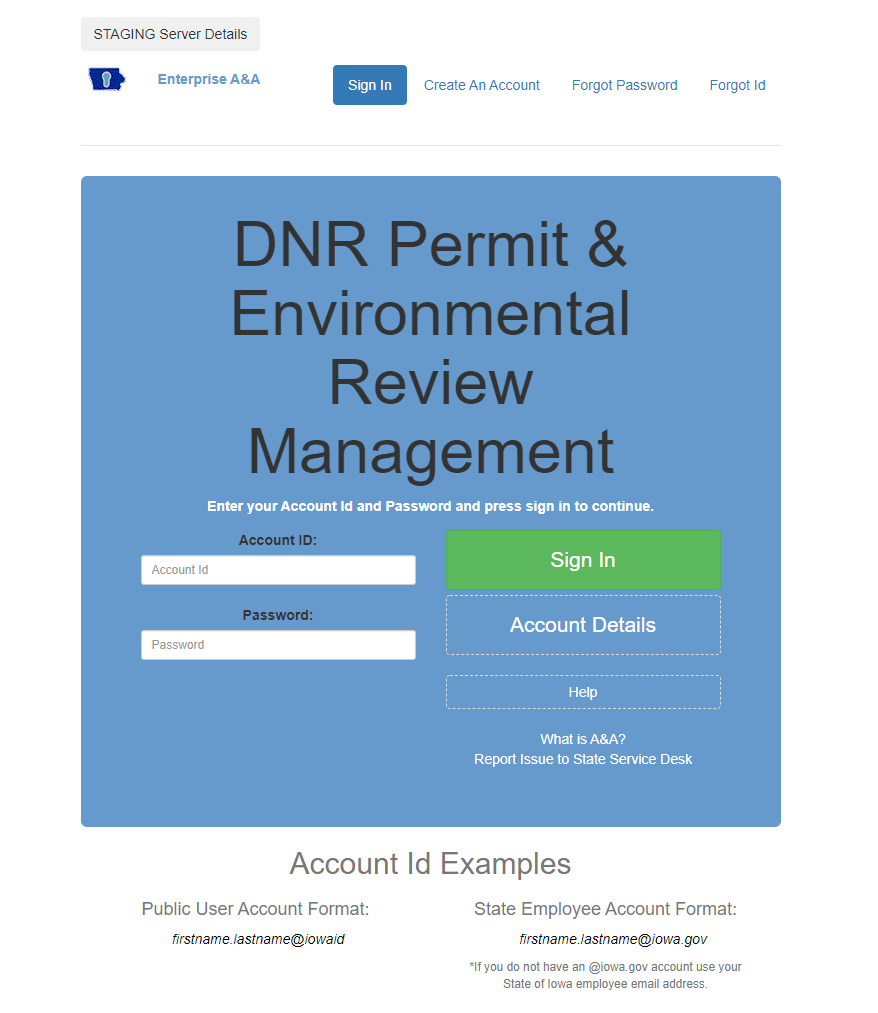
- This is the user ID and password used to log into a PERMT account. Follow the step by step instructions found at this link: https://entaa.iowa.gov/entaa/ssohelp.jsp
- Existing state ID’s can also be used. Early users have reported that they are also able to access this site using their existing Iowa DOT login.
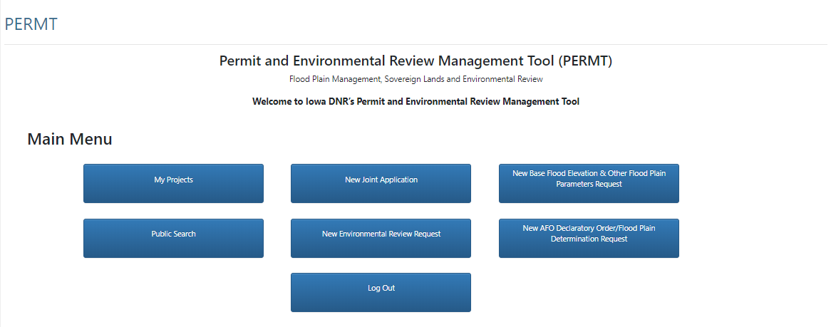
- My Projects – Applicant Dashboard used to access all four classifications of permit applications.
- Applications Started but Not Submitted – This includes all permit applications that were started by the Applicant, but have not been submitted to the Iowa DNR. Therefore, the review of this project has not started. The incomplete application can be resumed for submittal to the Iowa DNR.
- Projects In Review – This includes all permit applications that have been successfully submitted to the Iowa DNR. Clicking on the tracking number link (left most column) will expand the view for the Iowa DNR review status of the project. The US Army Corps of Engineer review status cannot be obtained on this website. Additional information can also be submitted at this location.
- Waiting for Notification from Applicant that Construction is Complete – This includes all permit applications that were approved (permitted) by the Iowa DNR, and require a Notice of Completion (NOC) when the construction phase of the project is complete. The NOC can be submitted electronically at this location.
- Closed Projects – This includes all projects that did not require a permit, or permitted projects that have received a NOC. Copies of Iowa DNR official response documents (projects completed after April 2020) can be accessed at this location.
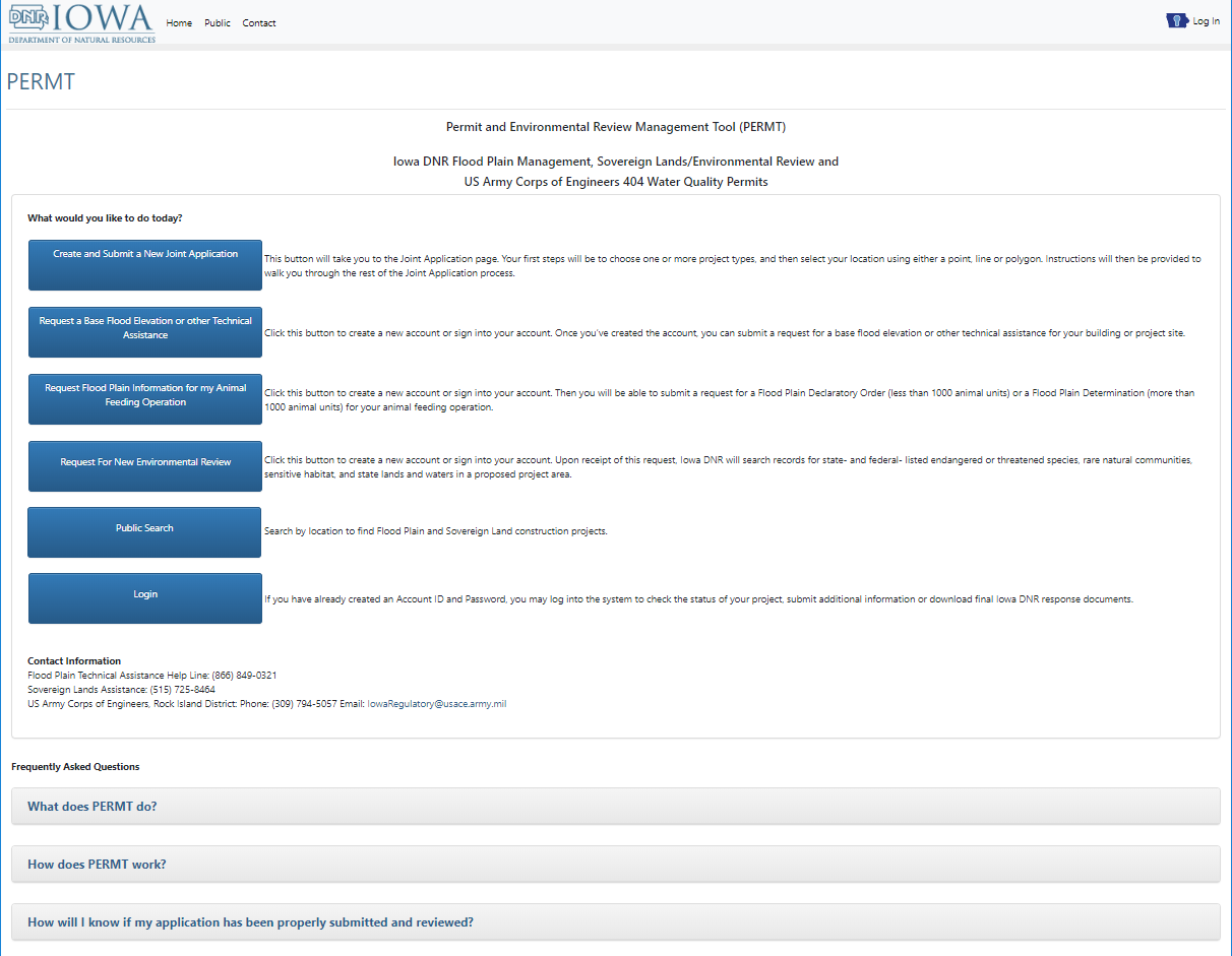
- Public Search – Applicant search for a specific recent project.
- New Flood Plain & Sovereign Lands Permit Application, New Environmental Review Request, New Base Flood Elevation Request, & New AFO Declaratory Order – Applicant links to specific submittal forms.
- Log Out – Applicant Log Out to limit access to their permit applications and submittal.
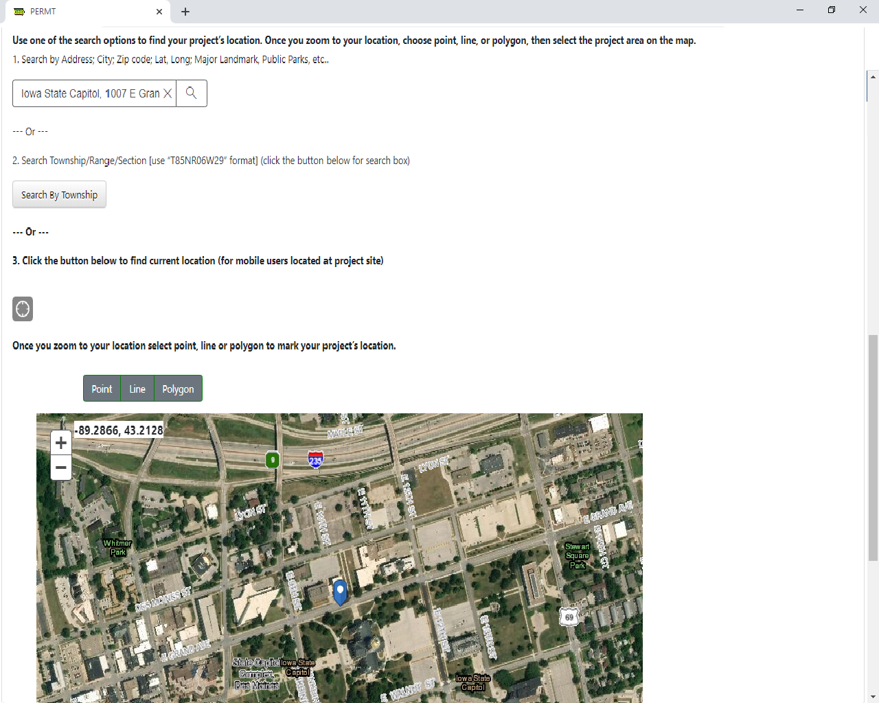
- Use one of the three search options provided, or hover over the interactive map and “zoom in” to the project site.
- Three Search Options – The three search options will typically provide a blue search result location marker on the map for your reference. The blue marker is temporary, and cannot be used by PERMT.
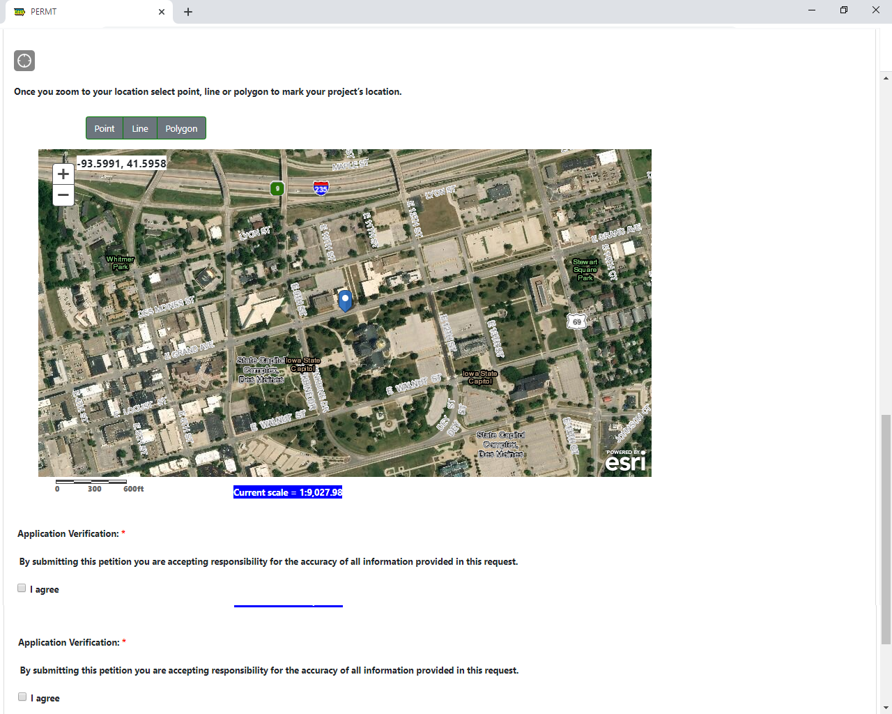
- Zoom In Option – There is “Current Scale” text located immediately below the map. Zoom into the project site until the background for this text changes from black to blue. The next step requires a zoom level with a blue background.
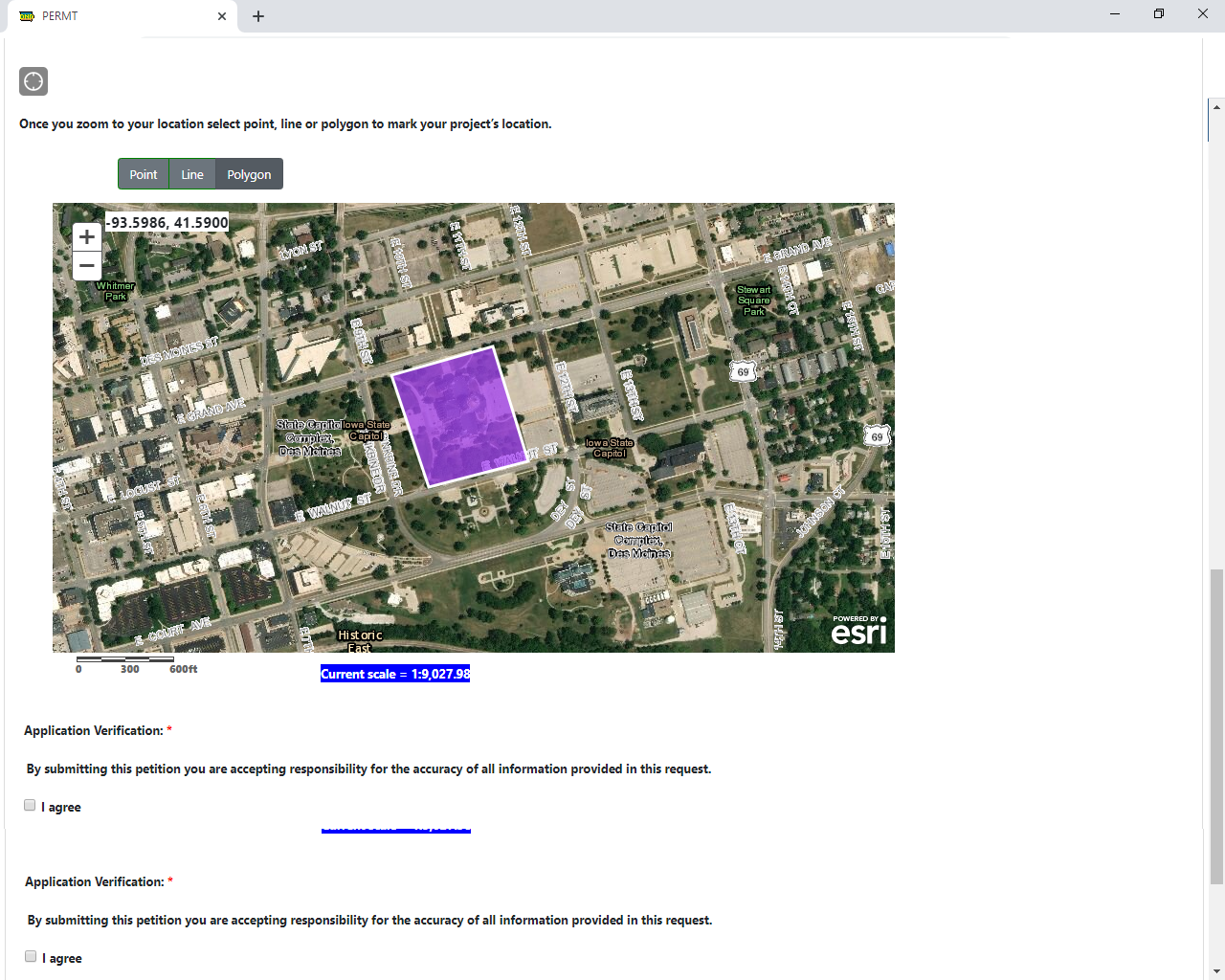
- Select one of the three (point, line, or polygon) options located directly above the interactive map to place a point, line or shape that covers your project limits. This will typically use a purple color for the project marker on the map.
- After the purple project marker has been placed, the user input project location can be used by the system. You can move on to the next step.
This can be used to identify recent neighboring projects that have submitted an application to the Iowa DNR.
Public Search Limitations: Information on map is provided “as-is”, and may not include a complete list of permit applications for that location. Additionally, the project locations identified on this map are not always correctly located due to online user error, changes in background imagery, and other contributing factors. This map is limited to permit applications from the Iowa DNR Flood Plain and Dam Safety Section, and the Iowa DNR Sovereign Lands Section.
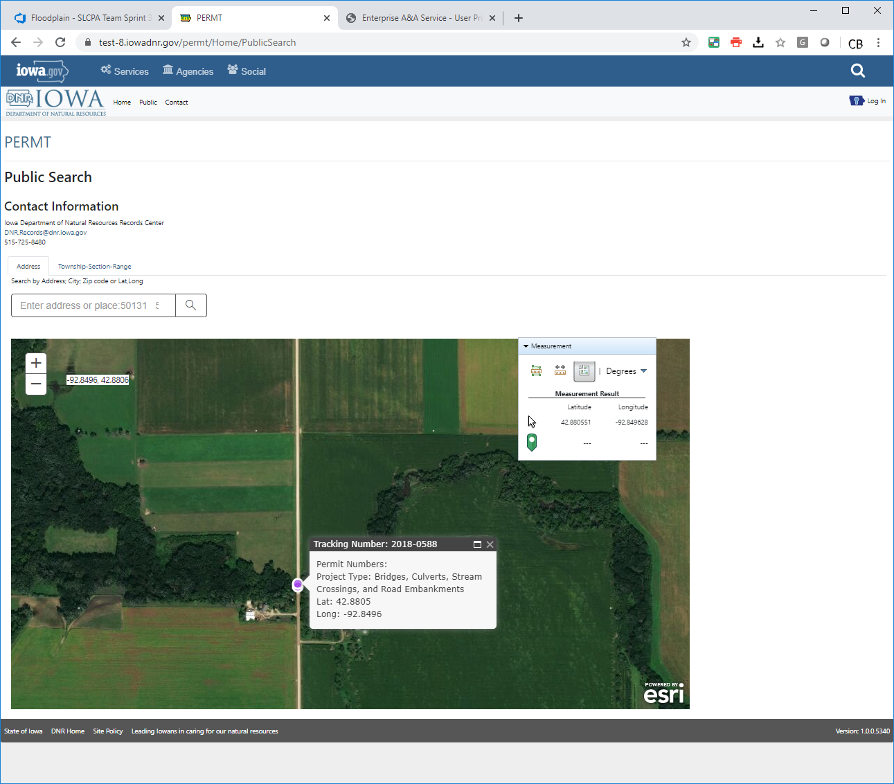
- Search for the project location using one of the two tabs (“Address” & “Township-Section-Range”), or hover over the interactive map and “zoom in” to the project location.
- Two Search Options – The two search options can be used to help find your project site.
- Zoom In Option – Simply zoom into the project site until you can see your project location and any neighboring projects.
- For additional information on a particular project, you may call the Iowa DNR contacts. Use the contacts link at the top of the page for contact information, including contacts for the DNR Records Center. The Iowa DNR records center contact information is provided on this page.
- Measurement Tab – This map includes a measurement drop down tool located near the top right corner of the interactive map. The tool can be used for approximate calculations of: areas, lengths, and locations (latitude and longitude).