IWIS - Home
Welcome to the Iowa Wells Information System (IWIS) Application.
The IWIS stores information about private wells in Iowa including location, depth, geology, and water quality. The map search allows for viewing and querying well data based on mapped location. The text search allows for viewing and querying well data based on specific search fields.
For more information about the Private Well Program, please follow this link: Private Well Program
Map Search
Search for wells using the map functions.
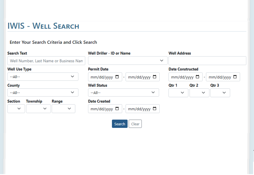
Text Search
Search for wells using location, date, use type, and other filters.